Kansas Watershed Story Maps
One Kansas Watershed Story
Every watershed has a story to tell in a language written by nature listened to by watershed modelers. Every watershed modeler wants to translate that message for all to understand, that is -- Watershed’s across Kansas face threats from anthropogenic activities preventing them from providing adequate life-giving ecosystem services.
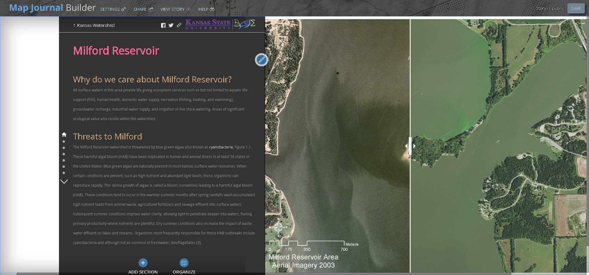
Biological and Agricultural Engineering’s Watershed Modeling group led by Dr. Aleksey Sheshukov and PhD student Dereatha Cross explored the use of the ESRI Story Map tool, an interactive way to share and communicate Kansas watershed stories to the world utilizing authoritative maps with text, images, and multimedia content. Several Online Story Maps (list below) were created using Watershed Restoration and Protection Strategy plans. Using the Story Map tool, visitors can utilize the interactive web pages to explore threats Milford Reservoir watershed area faces, learn about the background, explore physical hydrological descriptions, impacts of land use land cover, total maximum daily loads of pollutants the watershed systems must process, learn about potential sources of pollutants, and remediation strategies. Map elements can be selected, layer links control information displayed, maps can be zoomed and panned, and legend items translate map element meanings.
Online Story Maps provide watershed specialists and scientists an effective way to share Kansas watershed stories with public.
Cover story for One Kansas Watershed project:
One Kansas Watershed Stories: